![[Live from Earth and Mars]](../../graphics/mars_map.gif)

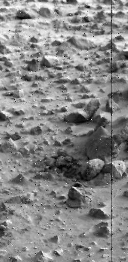
Beginning on Sol 296, Viking Lander 1 began constructing conical piles of soillike materials by collecting materials from the sample field and depositing them on top of rocks and among rocks with the surface sampler collector head (a scoop).
The purpose of the piles of soillike materials was to create topographic configurations of disturbed materials that are not in equilibrium with the present-day environment of Mars.
All but one of these piles were made of a weak powder-like "soil" and one was made of a garden-like "soil."
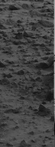
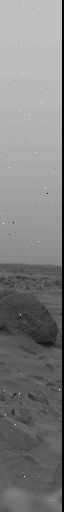
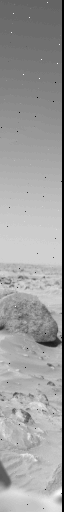
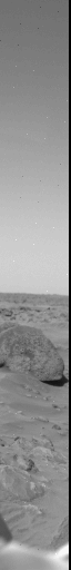
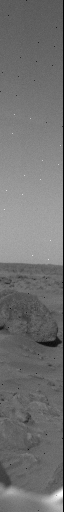
Three of these piles can be seen in high-resolution (0.04 degrees/pixel) Camera 1 picture 11J013/921. They look like miniature stratovolcanoes. (In this image, the sun was toward the right so that the shadows are on the left sides of piles and rocks)
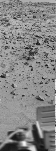
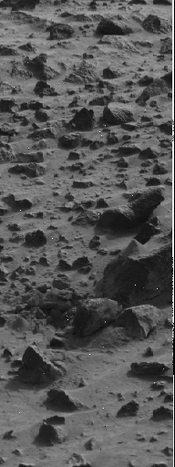
Can you also find these three piles in low-resolution (0.12 degrees/pixel) Camera 1 picture 11J081/1402?
Splendid! You are a good observer.
Did you also notice that you can see the horizon and sky near the top? The elevation angles go from +0.66 degrees to -60.66 degree. Starting and ending azimuths are 264.5 and 287.0 degrees.
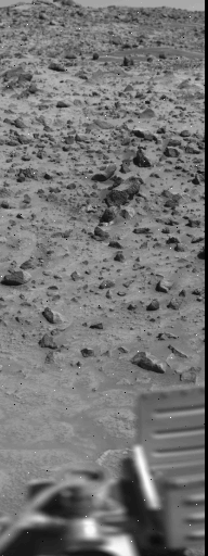
Compare picture 11J081/1402 with picture 11J171/2068.
11J100/1543 11J190/2209
Compare high-resolution (0.04 degrees/pixel) picture 11J100/1543 or 11J013/921 with picture 11J190/2209. (Note that the starting and ending azimuths for J100 and J190 are 269.5 degrees and 277.0 degrees and starting and ending elevations are -9.78 and -30.22 degrees - all three are Camera 1 pictures).
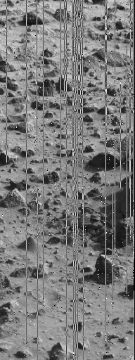
The right part of Camera 1 picture 11J013/921 and Camera 2 picture 12J108/1601 form a stereopair (if you want to look at the piles in stereo - see EXERCISE 3). The starting and ending azimuths for Camera 2 picture 12J108/1601 are 82.5 and 90.0 degrees and starting and ending elevations are -9.78 and -30.22 degrees.
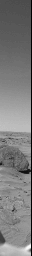
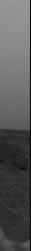
Lander 1 took many pictures of the same scene separated by many sols in order to detect changes. Three sets of such images are narrow low-resolution color pictures taken of the sky and surface. In the color images below, the horizon and a rock named "Big Joe" are included; Big Joe is 8 to 10 meters from Camera 1. The starting and ending azimuths for each picture are 160.0 and 165.56 degrees and starting and ending elevations are +30.66 and -30.66 degrees. About how tall is Big Joe?


What do you think happened on Mars?
About when did it happen?
Which way did the wind blow?
What are the largest sizes of fragments that were moved?
What are the largest sizes of fragments that remained in pile #5?
Why don't you write a story about what happened? Scientists have to write stories (they call them papers).
The map that has been furnished (see note, link, and warning below) shows a plan view of Viking Lander 1.
If you look carefully at the map, you can see two pairs of concentric circles with "plus" signs in their centers. They are labeled Camera 1 (left one) and Camera 2 (right one).
The dashed lines extending from the "pluses" are the reference directions for each camera. The reference direction for Camera 1 extends to the right of the Camera 1 "plus" and the reference direction for Camera 2 extends to the left of the Camera 2 "plus."
Can you find the three piles of "soil" within the area formed by the sample field and the wedges on the map?. What else can you see in the images within the wedges on the map? Can you find two other conical piles (#1 and #4) on the map?.
(Note. Approximate "boltdown and diode" corrections are included in the azimuths given)
(Note. The working map on this WEB site, which is linked below, is a suitable base map. The extended mission map in the back of Professional Paper 1389 is also suitable. If the Lander 1 map is difficult to read, or too large for your computer and you do not have Professional Paper 1389, you can request copies of the map from James E. Tillman or Henry J. Moore .
This section includes a link to the map for this exercise.
Do not click on the link below unless you have a very fast link, a
large memory and a capable system. The biggest, fastest workstations
take about 30 seconds to ingest and display them.
Lander 1, end extended mission. [Bit Map: 3.98 Mbytes]
| The data, maps, and text for this exercise were supplied by: Dr. Henry John Moore Scientist Emeritus Astrogeology Team MS 975 U.S. Geological Survey 345 Middlefield Road Menlo Park, CA 94025 moore@astmnl.wr.usgs.gov |
The images, layout, and presentation for this exercise were supplied by; James E. Tillman, Research Prof. (mars@atmos.washington.edu ) and George F. LeCompte (a volunteer) Department of Atmospheric Sciences PO Box 351640 University of Washington Seattle, WA 98195-1640 |