Cumulonimbus
 |  | Billowing Cumulonimbus
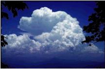
This photo of a billowing cumulus cloud came from the GLOBE program. This is clearly an opaque (very thick) cloud. Cloud cover is hard to determine from this single view, but is probably partly to mostly cloudy. |
 | | Thunderstorm This wide-angle photograph shows an intense early evening (about 6:15 pm) thunderstorm over Virginia Beach as observed from Poquoson, Virginia (a distance of about 25 miles or 40 km). The weather earlier in the day had been unsettled due to the passage of a cold front; however, the appearance of the thunderstorm was surprising since the sky conditions were mostly clear in Poquoson.
The photographer was alerted to the presence of this thunderstorm during the broadcast of the local weather report when radar images indicated intense rainfall over Virginia Beach. Photo by David Kratz. |
 | | Developing Thunderstorm This striking photograph shows the developing phase of a summer thunderstorm in New Jersey, USA. Note the very dark appearance of the base of the cloud, which is an indication of a very thick developing cumulus cloud. Also note the vivid interplay of sunlight at the cloud edges.
Photo by Rosemary Fields, of Hunterdon Christian Academy, Flemington, NJ, USA, in North Branch, NJ, August 2002. |
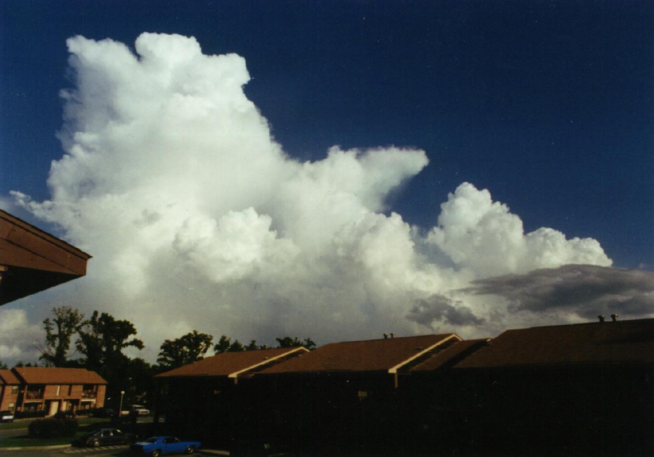
 | | Top of Cumulonimbus A good shot of a developing cumulus congestus cloud with some glaciation (cap cloud or pileus) starting to form at the top. Photo from Forest Park High School, Woodbridge, Va. 1st place in April 2003 S'COOL cloud photo contest.
|
 | | Cumulonimbus with Rain An excellent picture clearly showing precipitation falling from a cloud. Capturing precipitation from a cloud in a photo is not always easy to do. Photo from Mazenod College, Perth, Australia. 2nd place in April 2003 S'COOL cloud photo contest.
|
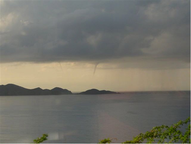 | | Cumulonimbus with Waterspouts A striking picture of waterspouts, and rain too!
Photo from Cedar School, Cruz Bay, Virgin Islands. 3rd place (tie) in April 2003 S'COOL cloud photo contest. |
 | | Cumulonimbus with Heavy Rain Low hanging cloud under cumulonimbus. Heavy rain obscuring island. Good updraft (dark base).
Photo from Cedar School, Cruz Bay, Virgin Islands. 3rd place (tie) in April 2003 S'COOL cloud photo contest. |
 | | Under a Cumulonimbus Cloud This is what it looks like underneath a cumulonimbus (thunderstorm) cloud. Notice the strong downdrafts indicating active convection and the very opaque cloud on the right of the picture. Photo by Kevin Larman in Colorado.
|
 | | Under a Cumulonimbus Cloud - II Another possible thing you can see beneath a cumulonimbus cloud is called mammatus. This is an indication of very active updrafts and downdrafts and can be a sign of severe weather. This particular photo was taken after a VERY intense thunder/ rain storm. Presumably there were more extensive and larger mammatus earlier, but it was pitch dark during the storm! Photo by Laura Hinkelman in Connecticut.
|