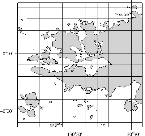
We now arrive at our final plot, which shows a detailed view of the western side of the small island of Waigeo. The map area is approximately 40 by 40 km. We call upon the full resolution data set to portray the richness of geographic detail within this region; no features are ignored. The full resolution has undergone no decimation and it shows: The combined file size of the coastlines, rivers, and borders totals a hefty 55.7 Mbytes. Our final map is reproduced by the single command:
pscoast `./getbox -JE130.35/-0.2/1i -20 20 -20 20` -JE130.35/-0.2/3.5i -P -Df -Glightgray -W0.25p \
   -N1/0.25tap -B10mg2mWSne > GMT_App_K_5.ps
We hope you will study these examples to enable you to make efficent and wise use of this vast data set.