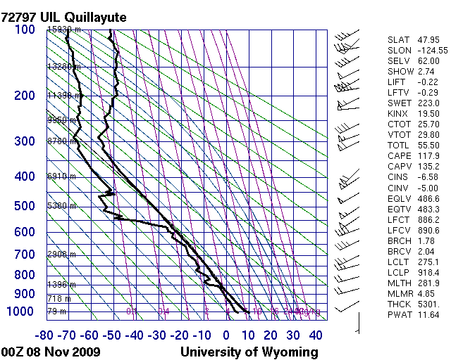
Here is what the 1-km visible satellite imagery shows for this period, and here is a high resolution MODIS image and a lower resolution MODIS image. Here is the Quillayute sounding for 0Z on the 8th.
Working on Solutions
To help fix this, several approaches have been tried:1) turning off the cumulus scheme for this domain
2) turning on 6th-order diffusion in various amounts.
The loops in this table illustrate the attempts and how they impact the simulations.
| Domain | Product | Hour | Cases (control click to select multiple) |
|---|---|---|---|
 |

|