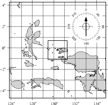
We continue to zoom in on the map center. In this map, the
edges of the map are all 500 km true distance from the projection
center. We abandon the low resolution data set as it would look
too jagged at this scale and instead employ the intermediate
resolution data that faithfully reproduce the dominant geographic
features in the region. This time, we ignore features less than
20 km![]() in area. Although the script still asks for national
borders none exist within our region. The intermediate database
is moderately decimated and simplified by the DP-routine: The
combined file size of the coastlines, rivers, and borders now
exceeds 3.28 Mbytes. The plot is generated by the commands:
in area. Although the script still asks for national
borders none exist within our region. The intermediate database
is moderately decimated and simplified by the DP-routine: The
combined file size of the coastlines, rivers, and borders now
exceeds 3.28 Mbytes. The plot is generated by the commands:
pscoast `./getbox -JE130.35/-0.2/1i -500 500 -500 500` -JE130.35/-0.2/3.5i -P -Di -A20 -Glightgray \
   -W0.25p -N1/0.25tap -B2g1WSne -K > GMT_App_K_3.ps
echo 133 2 | psxy -R -J -O -K -Sc1.4i -Gwhite >> GMT_App_K_3.ps
psbasemap -R -J -O -K -Tm133/2/1i+45/10/5:: --HEADER_FONT_SIZE=12p --TICK_LENGTH=0.05i \
   --ANNOT_FONT_SIZE_SECONDARY=8p >> GMT_App_K_3.ps
./getrect -JE130.35/-0.2/1i -100 100 -100 100 | psxy -R -JE130.35/-0.2/3.5i -O -W1.5p -L -A \
   >> GMT_App_K_3.ps
 |