The transverse Mercator was invented by Lambert in 1772.
In this projection the cylinder touches a meridian along
which there is no distortion. The distortion increases away
from the central meridian and goes to infinity at 90![]() from
center. The central meridian, each meridian 90
from
center. The central meridian, each meridian 90![]() away
from the center, and equator are straight lines; other parallels
and meridians are complex curves. The projection is defined
by specifying:
away
from the center, and equator are straight lines; other parallels
and meridians are complex curves. The projection is defined
by specifying:
The optional latitude of origin defaults to Equator if not specified.
Although defaulting to 1, you can change the map scale factor via
the MAP_SCALE_FACTOR parameter.
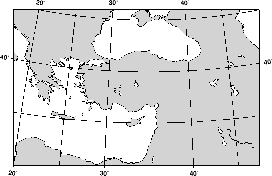
Our example shows a transverse Mercator map of south-east
Europe and the Middle East with 35![]() E as the central
meridian:
E as the central
meridian:
pscoast -R20/30/50/45r -Jt35/0.18i -B10g5 -Dl -A250 -Glightgray -W0.25p -P > GMT_transverse_merc.ps
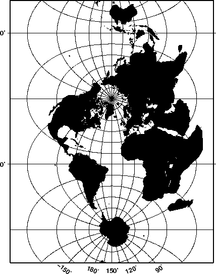
The transverse Mercator can also be used to generate a global map--the
equivalent of the 360![]() Mercator map. Using the command
Mercator map. Using the command
pscoast -R0/360/-80/80 -JT330/-45/3.5i -B30g15/15g15WSne -Dc -A2000 -Gblack -P > GMT_TM.ps